Mapping for Diplomacy: A Virtual 'Mapping for Global Health' Mapathon
MapGive held the second annual Mapping for Diplomacy event in partnership with the National Museum for American Diplomacy
On April 28, 2020, MapGive held the second annual Mapping for Diplomacy event in partnership with the National Museum for American Diplomacy (NMAD) - a virtual MapGive mapathon focused on “Mapping for Global Health.” While not the first MapGive mapathon that focused on public health (learn more about MapGive’s ongoing support for PEPFAR related mapping projectshere), it was timely due to the unique challenges the COVID-19 pandemic is creating for public health systems, commerce, well-being, and quality of life.
A virtual mapathon was a first for MapGive and presented new challenges;however, MapGive’s partnership with the NMAD, as well as observing other successful virtual events in the mapping community, led to an effective plan. The mapathon hosted 155 attendees who participated from over a dozen countries. By the end of the afternoon, the map project was nearly 33% complete with over 3,600 new buildings created. The collected OpenStreetMap (OSM) data will be used to support public health planning by the Government of Gabarone for their COVID-19 response.
What is MapGive?
Launched in 2014, MapGive is a State Department initiative that encourages and increases volunteer participation in the global mapping community and facilitates the creation of open geographic data to support humanitarian and development efforts. This initiative brings volunteers together to help fill in the gaps in existing data sets where data is either incomplete or does not exist at all. MapGive’s emphasis on collaborative online mapping allows for local communities and organizations all throughout the world to participate and address themes including education, urban resilience, and humanitarian response.
Better mapping for better public health response
Mr. Josh Glasser kicked off the presentations by discussing how government and communities at all levels address pandemic threats through geographic and mapping tools (Glasser). Public health mapping has value in foreign policy, as it is concerned with both risks and outcomes for populations. Maps are effective ways to more cleanly and intuitively present the data from these outcomes than other data visualization or communication tools; furthermore, maps predict areas of concern and target resources where need is the greatest. Additionally, outcome maps help identify where different populations are on the outbreak curve. Finally, using maps to monitor and forecast is important in analyzing pandemic threats because pandemics have a demonstrated pattern of passing through different regions at different times or phases (Glasser).
Senior Advisor for Public Health at the National Institute for Environmental Health Sciences John M. Balbus, MD, MPH, presented on mapping for public health. Unlike Precision Medicine, which focuses nearly exclusively on people’s genetic disposition, Precision Public Health brings in the use of data at very fine scales to understand people’s environments and help pinpoint life-saving interventions. There are opportunities for improved health through integrated earth observations and mapping, including enhanced prediction of epidemics, pandemics, and seasonal variations in disease. In addition, health care facilities can be monitored remotely from satellite imagery and ground truthing. Being able to understand where these facilities are and where they lie with respect to other types of potential hazards, including environmental hazards, is very valuable information (Balbus).
Mapathon Task: Combining Remote and Local Mapping Efforts
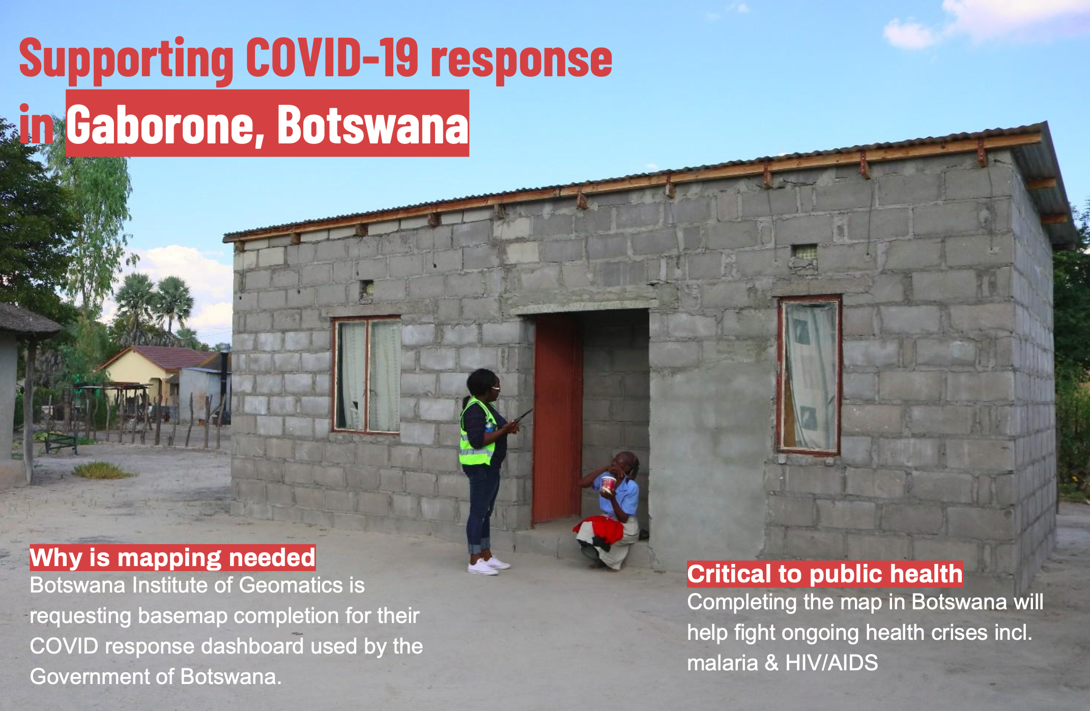
Supporting COVID-19 response in Gaborone. Photo credit: Humanitarian OpenStreetMap Team
Ms. Jess Beutler from the Humanitarian OpenStreetMap Team (HOT) presented information about the project that was mapped during the event, as well as HOT’s efforts during the COVID-19 pandemic (Beutler). Jess works to make sure remotely mapped data is used effectively on the ground by partners and governments, and that actionable data gets into the right hands. HOT is a global organization and a mapping community working to leverage OSM for disaster and humanitarian response. HOT’s goal is to make sure everyone in the world is counted. Map data is accessible and used in decisions that save and improve lives.
Lack of maps hinder the ability to respond to healthcare issues, thus making maps vital to COVID-19 response efforts including testing, treatment, and contact tracing. There is also a need to know where people are, including the most vulnerable populations, so the response can be allocated and prioritized. It is critical to understand where infrastructure is located, including distribution and treatment centers. For contact tracing, understanding place names and administrative boundaries can help understand where people have been, and local names and local knowledge are critical to achieve this (Beutler).
HOT is focusing on helping government agencies and responders, identifying populations most at risk, and increasing map creation in at-risk locations, including Cusco, Peru. HOT’s COVID-19 response started there, where the Peruvian ministry of health needed to identify where to conduct household surveys and prioritize aid distribution in response to lockdown measures. The lockdown had a considerable impact on the local population, which heavily depends on the informal economy. The complete maps also helped to increase the ability to distribute cash and food and support household surveys or contact tracing at a later point in time. Finally, HOT was able to provide GIS analysis to prioritize aid distribution, facilitate remote mapping to complete the basemap, and provide technical support and training (Beutler).
During the mapathon, mapping was done on a project requested by the Botswana Institute of Geomatics. The Institute’s project sought to complete the basemap for their COVID-19 response dashboard, which would later be used by the Government of Botswana. Completing the map in Botswana will help fight ongoing health crisis including malaria HIV/AIDS and future campaigns addressing malaria.
The Cities Navigator App
The final presenter, Dr. Gaston Mbonglou, described that, as part of the Secondary Cities project in Douala, Cameroon, the Cities Navigator App emerged in response to flooding (Mbonglou). The Cities Navigator App is a platform to improve communication and provide access to information about essential products and services. In Douala especially, it is important to provide people with streamlined and reliable information on flooded areas, and actions to take. In response to the COVID-19 pandemic, the Douala team realized that they could apply the Cities Navigator App to improve communications. This solution includes 3 pillars: information, communication, and access to services and products. The application displays the latest COVID-19 case information, a service finder is included, and routing is provided to navigate to these locations. It is also possible for government ministries and other authoritative sources to send messages via the app (Mbonglou).
The video and slides from the event can be accessed on the MapGive Mapping for Global Health event page.
This MapGive Story was also posted as a DipNote, the official blog of the U.S. Department of State. Find it here
Sources:
Balbus, John. Mapping for Public Health: Past, Present and Future.
Beutler, Jess. Creating Local Map Data Remotely.
Josh Glasser. Health Mapping and Foreign Policy.
Mbonglou, Gaston. The Cities Navigator App.