Events
Past Events
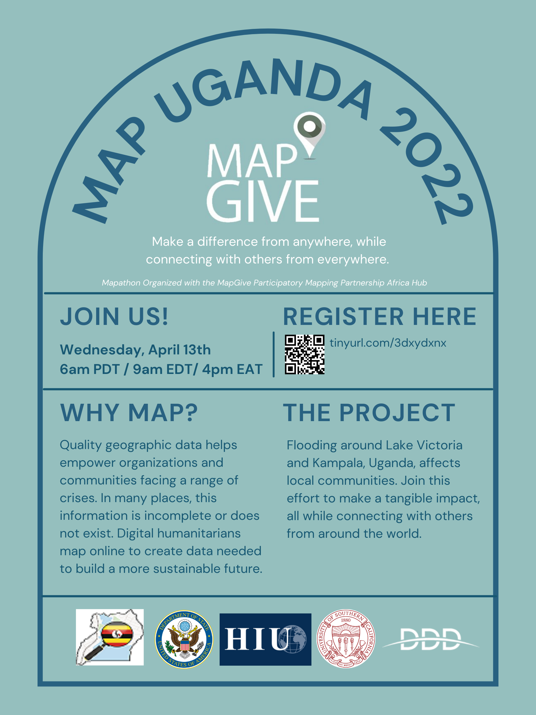
Participatory Mapping Partnership Africa Hub Mapathon
The U.S. Department of State’s MapGive hosted a “mapathon” with its Participatory Mapping Partnership Africa Hub as part of our public diplomacy initiative to engage individuals to map in support of humanitarian and development efforts - it took place on April 13th from 09:00-11:00 am eastern time/ 06:00-08:00 pacific time / 16:00-18:00 pm east africa time. This event was a collaboration with MapUganda, Digital Data Divide, the University of Southern California’s Annenberg School for Communication and Journalism, and various YouthMappers chapters, to bring people together worldwide to map communities affected by flooding in Uganda. The data created from this effort will be open-source and then used to support local development and humanitarian aid efforts in the region.
Event recording:
Slides:
Participatory Mapping Partnership Africa Hub Poster
CITIES' COVID MITIGATION AND MAPPING (C2M2) SYMPOSIUM
What comes next for the world’s cities after COVID-19? On June 22-25, hear from international experts at the front line of monitoring the pandemic and using spatial data to illuminate critical needs for societies to respond to impacts of COVID-19. Join us for a four-day Cities’ COVID Mitigation Mapping (C2M2) Symposium organized with our partners, the American Association of Geographers and Harvard University’s Center for Geographic Analysis.
The C2M2 Symposium will focus on different themes that have emerged from the pandemic: migration, livelihoods, and gender. We will discuss how the pandemic influences information needs, data sharing, and requirements for long-lasting sustainable projects and partnerships. The fourth day will demonstrate hands-on tools developed by C2M2 partners and collaborators. Registration is now open. This symposium is free and open to the public.
MapGive AI-Assisted Mapathon: Part I
The MapGive team held a mapathon and partnered with Maxar to explore different AI technologies that can help make mapping easier and faster. In addition, our partner The President’s Emergency Plan For AIDS Relief (PEPFAR) has identified mapping needs around clusters of health facilities in Nigeria where filling in holes in the map with publicly accessible open data can help local humanitarian and development activities.
Video:
Slides:
Mapping for Diplomacy: Mapping for Public Health Mapathon
The MapGive team held their second annual Mapping for Diplomacy event in partnership with the National Museum for American Diplomacy - a virtual MapGive Mapathon focused on “Mapping for Global Health.”
The mapathon hosted two speakers focused on how mapping can support epidemiology and policy decision making, and two other speakers who discussed using open data at the local level in support of COVID-19 response and other public health efforts (Humanitarian OpenStreetMap Team and 2C Alum from Douala, Cameroon). The mapping project focused on the Greater Gaborone area of Botswana; participants added 3600 new buildings to the map and completed about 30% of the project.
March 5th: El Salvador - International Women’s Day Day American Spaces Mapathons
MapGive and American Spaces in El Salvador are partnering to facilitate volunteer participation in crowdsourced mapping that supports humanitarian assistance and development programs, through 3 concurrent three-hour “Mapathons” at American Spaces in El Salvador, using an innovative PD initiative called MapGive. The Mapathon will be done on March 5th, 2020 to mark the International Women’s Day. Each American Space will have 15 volunteers mapping together for a total of 45 Salvadorans participating in the program.
The 2nd Mapathon @ AAG
This is the 2nd year that Mapathons and Mapathon related activities were hosted at the American Association of Geographers (AAG) Annual Meeting. Attendees joined a community of online mappers and contributed to five different OpenStreetMap (OSM) projects supporting humanitarian and development efforts. Using satellite imagery and freely available OpenStreetMap editing platforms, participants traced, edited, and labeled key infrastructure (buildings, roads, etc.). This year’s event consisted of 7 paper sessions, 2 panel sessions, 2 poster sessions, 2 OSM activities, 6 lightning talks, and 2 Mapathons.
OpenStreetMap Geography Awareness Week 2016
Nov 13th-19th, 2016 Teachers, students, community groups, map lovers, in the US and around the world, join together to celebrate geography and make maps with OpenStreetMap, the free and openly editable map of the world.
The Reality is Virtual: U.S. College Students Assist MapGive and USAID
College students impact the U.S. Government’s work in a wide variety of ways. Through the Virtual Student Foreign Service (VSFS), both the State Department’s MapGive Initiative and USAID have enrolled over 30 VSFS interns for the 2015-2016 school year. State of the Map 2016 presentation where we covered the projects these students have worked on, lessons learned, and how students can get involved next year.
The 2nd White House Mapathon
Building on the success of the first White House Mapathon in 2015, last week more than 140 mappers participated in this year’s events at the White House and 15 other locations – in seven states and three countries. The mappers used open geographic data to improve mapping in rural areas of the United States, better identify public transit routes to our Nation’s parks, and prioritize malaria prevention projects around the globe. An additional 1,500 people participated via livestream.
AAG Mapathon
The first Mapathon at the AAG Annual Meeting featured speakers and support from the State Department’s Office of the Geographer, the Department of Geography and Geoinformation Science at George Mason University, USAID GeoCenter, American Red Cross, Peace Corps, the World Bank, and the AAG. organizers inspired and educated participants about the power of volunteered geographic information for humanitarian response and sustainable development.
International Women's Day - Mapathon
In support of International Women’s Day, The American Red Cross has teamed up with Humanitarian OpenStreetMap, Peace Corps, Mapgive, OSM US, and OpenstreetMap Foundation to host a Women’s mapathon on March 8.
Piura - MapGive Field Project
MapGive, together with the U.S. Embassy in Lima and Universidad de Piura (UDEP), with technical assistance from MapBox Ayacucho, organized the Piura MapGive Workshop to train over fifty students and professionals in a suite of OpenStreetMap (OSM) based skills and tools designed to empower participants with the capability to map Piura comprehensively.
Open Mapping for Diaspora Members Virtual Mapathon
Far from home, but want to map your community? Join our online workshop on OpenStreetMap, sponsored by the State Department’s MapGive initiative and the Peace Corps. Wednesday, October 14, 2015 from 11:00 AM to 12:00 PM (EDT).
Cusco - MapGive Field Project
August 22 to 23 in Cusco, Peru, as part of the collaboration between the National University of San Antonio Abad of Cusco and Secondary Cities Initiative. The participants were a mix of college students and professionals in the Peruvian government. The workshop introduced techniques for gathering field data in OpenStreetMap (OSM) using OpenMapKit and FieldPapers; OpenStreetMap editing; and using OpenStreetMap data in GIS; and focused particularly on areas of recent urban growth in Cusco.
Intro to OSM for Humanitarian Response + Mapping for Nepal
April 29th, We hope you can join us to to dive in and help with emergency humanitarian assistance following this weekend’s devastating earthquake in Nepal. This event will be co-hosted by our friends at MissingMaps, HOT (Humanitarian OpenStreetMap Team), Red Cross & Maptime DC.
The White House Mapathon
Citizen cartographers join the White House Office of Science and Technology Policy and Office of Digital Strategy for the first-ever White House Mapathon.
Earth Observation Day
April 8th 2015, The purpose of Earth Observation Day is to recognize the importance of using remotely sensed data to monitor the Earth and its environments to promote the use of remotely sensed data by K-16 teachers and students.
MapOff
March 27th 2015, George Mason University and George Washington University.
Connect Camps
The Connect Camps offer an opportunity for alumni of the Mandela Washington Fellowship to share the professional skills and networks they acquired from the Young African Leaders Initiative with other young African leaders in their rural communities. MapGive trained participants and led community mapping sessions.
OpenStreetMap Geography Awareness Week
Nov 18th 2014, Teachers, students, community groups, map lovers, in the US and around the world, join together to celebrate geography and make maps with OpenStreetMap, the free and openly editable map of the world.
Ramallah Mapathon
American Consulate General Co-Sponsors Palestinian University Students’ Efforts to Map West African Nations Stricken with Ebola